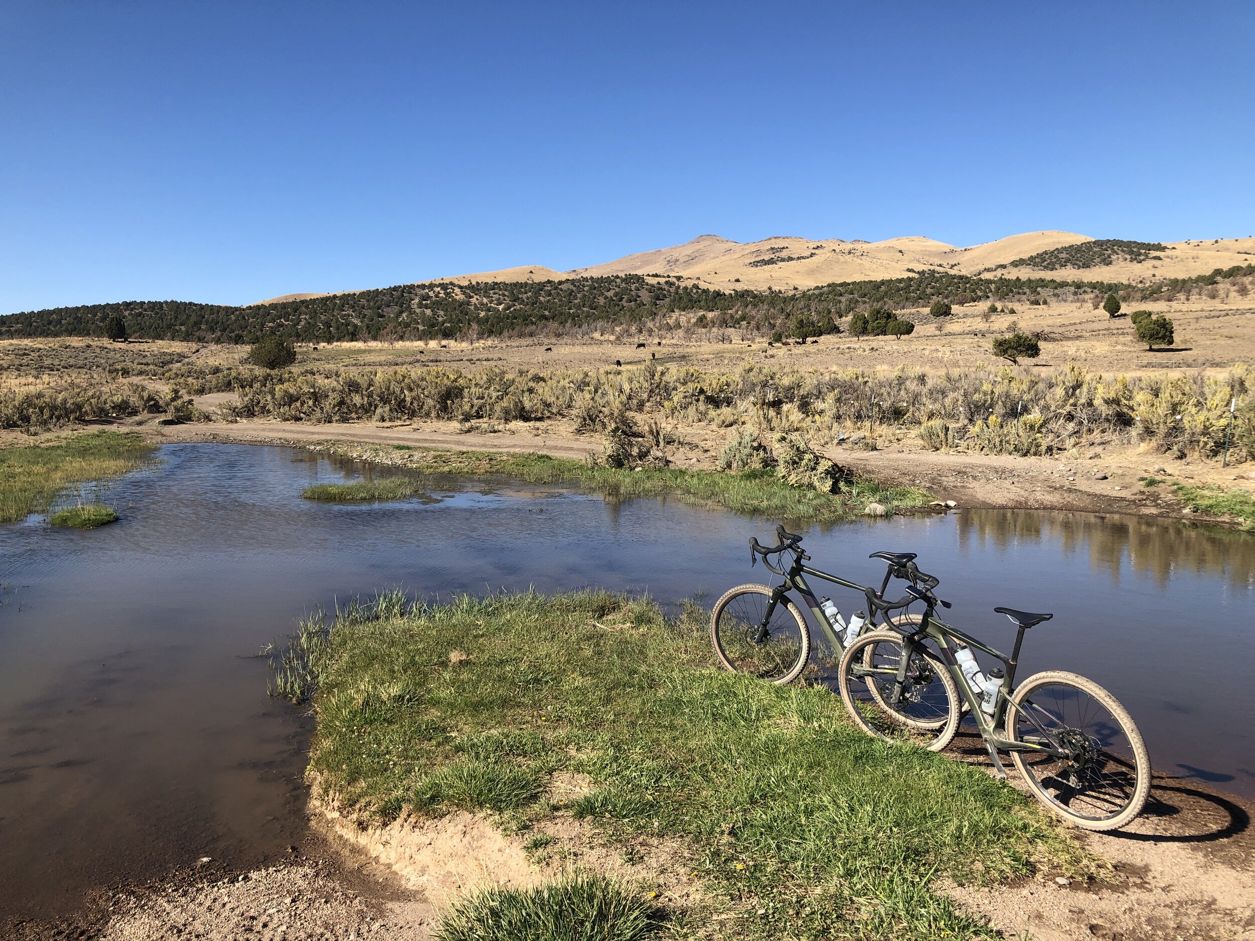
The end of the maintained section of Winnemucca Ranch Road. Deer Valley Creek, which is not a creek at all. The water just trickles into the wide part of the road. This is really a swimming pool fed by a very small hose.
Winnemucca Ranch Road is located North of Reno - Sparks on Pyramid Highway (Hwy 445). I have very little information about the area other than to find out that it was a Immigrant route into California from Pyramid Lake. There is the beautiful Marshall Ranch, a 480 acre ranch including beautiful Paiute Meadows. The ranch is surrounded by BLM land, and is just a beautiful location. Immigrants would use this route to get to Sierra Valley, and continue to what we now know as Portola and Quincy. (If anyone knows more about the history of this area, I would love to listen.) This area amazes me as to how much water exists around this entire loop.

Rebecca on Winnemucca Ranch Road
From Reno, it is about 45 minutes to the first start, or an hour drive to the second start point where the road is no longer maintained by Washoe County. The first part of this ride is perfectly smooth and beautiful. Once you reach the end of the County Road, it gets a little rocky in sections, but overall is beautiful. I rode the ride on a Cannondale Topstone Lefty Gravel Bike with 47mm tires. The rocky sections would suite a 29er well, but the smooth riding sections suite a Gravel bike well. The second part of this ride is about 75% smooth and beautiful, and 25% rocky, a little technical and slow. But if you are a desert rat like I am, it is a beautiful ride. Probably best done early morning, or evening due to heat, but would be an amazing ride in spring or fall.
Part 1. Strava Link for Part 1

You can’t really see Marshall Ranch from the road. It is hidden just up a canyon to the left of this picture. But with all the stadium seating, this must have been quite a little rodeo area in it’s time.
From Reno, find Pyramid Highway, Hwy 445. From I-80, Follow Pyramid Highway north for about 17 miles and turn left onto Winnemucca Ranch Road. Follow Winnemucca Ranch Road for about 8.5 miles. You will cross a cattle guard and a wash, and you will see a parking area on the right. Park here for Part 1. You could start way back, but there is an off road recreation area on the south side of the road called Moon Rocks. All the vehicles and ATV’s fly up and down the road and cover you in dust. There is also a glider airport on the North side of the road. They also cover you in dust. Once you get 8.5 miles out, you are past all of the recreational traffic, and you tend to be all by your self. Then maintained section of this road is 8.5 miles out to Deer Valley Creek. This is not a creek at all, rather a natural spring that feeds this wash. Just so happens that it spans the road making a muddy crossing. From the start, it is a gradual climb most of the way, with a good little climb at the end, then a quick descent to Deer Valley Creek. At this point, you can turn around and head back for almost 17 miles and 1600 ft of climbing. Here is the Strava link for Part 1.
Part 2. Strava Link for Part 2
Dry Newcome Lake below, and the green patch to the right is Newcome Spring.

Newcome Spring that looks like it used to be a Homestead at one time. This drains into now Dry Newcome Lake.
Remember that you can always link these 2 rides together for almost 40 miles, or use a cutoff for a 30 mile ride. Part 1 ends at Deer Valley Creek, and Part 2 starts at Deer Valley creek for almost 21 miles. Park just above Deer Valley Creek for the start. You will have 2 gates to go through. Please close them behind you. Just a quick 100 yards to the creek which is really not a creek at all. It is more like a swimming pool that is fed by a very small garden hose from the spring up the canyon. I tried to ride through the water crossing, and sank my wheels up to the hubs. I recommend just walking through, or pull your shoes and socks, walk across and put them back on. Depends on the time of year and if cold feet will make your ride miserable. Once you cross the water, the road turns to rocks and climbs. This rocky section is just over 100 yards long, then the road smoothes out. In 1 mile, you will see a road on your left. I rode this counter clockwise, but you can ride it either way. However, this is your return intersection no matter which way you ride it. For this write up, stay strait, or the right fork. The road continues to climb through rocky section, to smooth section and back for about 1.5 miles where you crest the climb.
Dry Fish Spring Lake below.
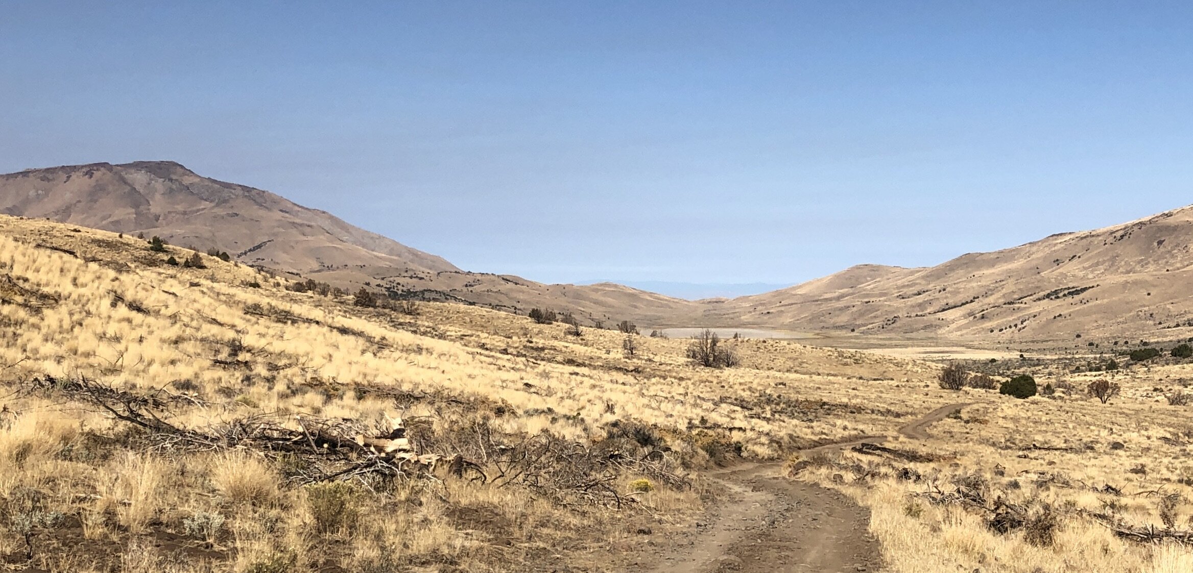
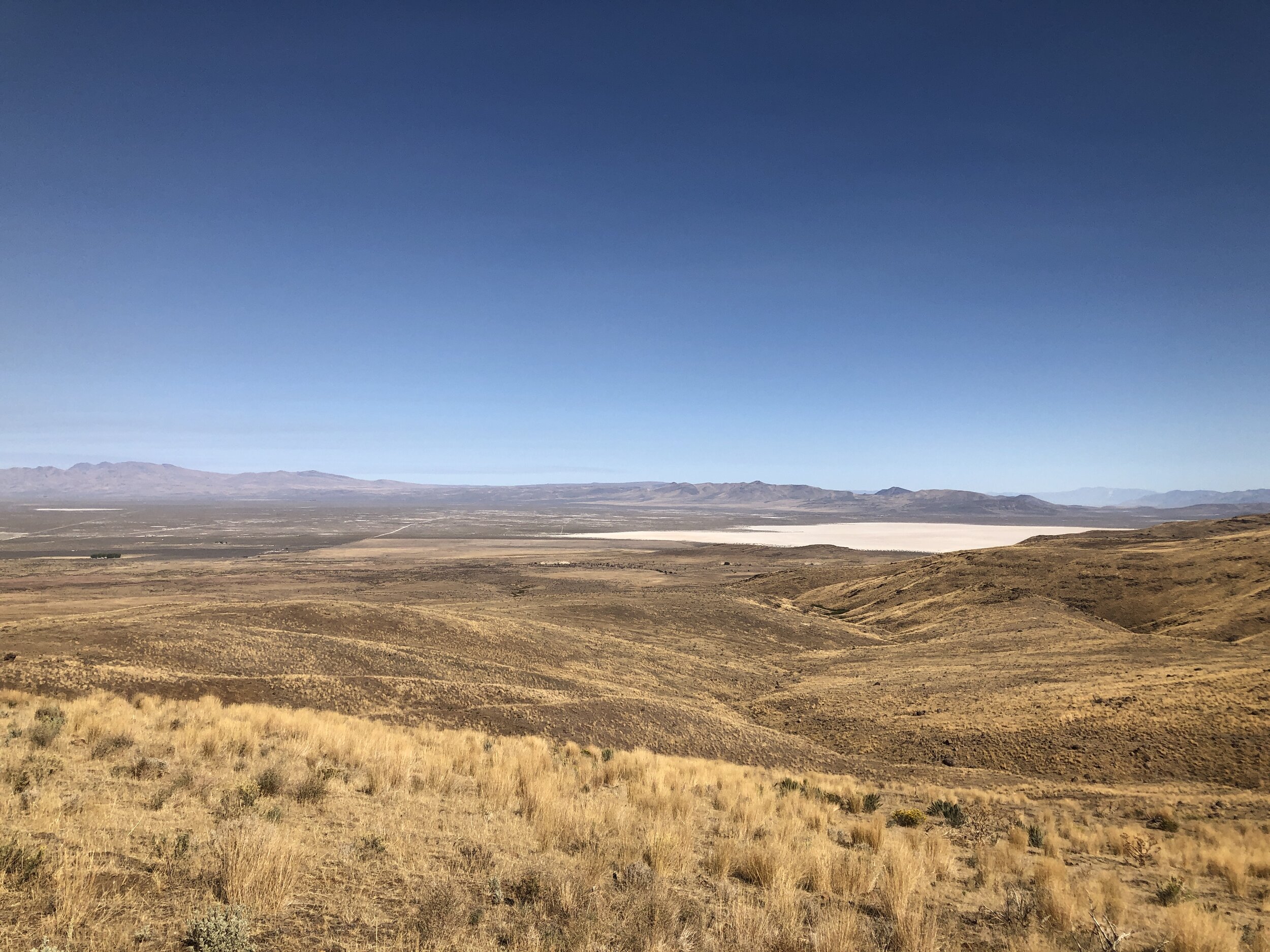
Here you can see Newcome Lake. This is really just a sink where water can’t escape. I am sure it is full of water in the spring, but now, in late September, it was completely dry. The downhill is about 2.5 miles to the leading edge of the lake, and on the way down you will pass Newcome Spring. It appears as if this used to be a homestead of some sort. There are what appear to be rock wall foundations, and this lovely water retention tank. From here, it is just a quick drop into Dry Newcome Lake. Now you have a choice if the lake is dry. You can ride across the east side of the lake, and at the south side is another jeep road that will cut this ride down to a 10 mile loop. The road is nice and smooth. If you want more mileage, continue west for 3.5 miles and you will climb out of the lake bed and up to the ridge. You will see water almost the entire way from a small spring up the hillside. Once you crest the ridge, you will have a fantastic view of Honey Lake and Dry Fish Springs Lake. You have to go just past your left turn to crest the ridge, but it is worth the view. Now retrace back to the fork in the road and stay right. The road is a gradual smooth uphill for a mile and you will again crest a ridge. Now you have a 4 mile downhill. Slightly rocky sections, but not bad. You follow the road almost due south until you intersect you left turn return road. If you go right, you will end up in Red Rock Road Estates. Turn left, and in a couple hundred yards you will come to another fork in the road. The left is the return road from Newcome Lake (the 10 mile shortcut.) Stay to the right and the road will climb, steep in sections for just over 3.5 miles again following a spring water run off on the left side of the road. Once you crest the ridge, it is a quick down hill, quick uphill and back to the first fork in the road you encountered near the start. Stay right, and follow the road back to Deer Valley Creek where you parked.

Just another of the many water crossings.
WHEN ACCESSING THE RIDE WITH GPS LINK BELOW, THERE IS A DROP DOWN MENU ON THE UPPER RIGHT OF THE MAP. THIS DROP DOWN MENU ALLOWS YOU TO CHANGE THE KIND OF MAP YOU ARE LOOKING AT, FROM A GOOGLE SATELLITE MAP TO A USGS TOPO MAP, AND ANY OTHER MAP IN BETWEEN. IF YOU WOULD LIKE THE GPS FILE FOR YOUR GARMIN, FEEL FREE TO E-MAIL OR CALL THE SHOP.